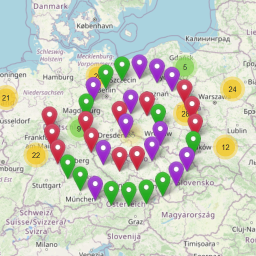
前言介紹
- 這款 WordPress 外掛「Waymark」是 2019-07-24 上架。
- 目前有 800 個安裝啟用數。
- 上一次更新是 2025-04-18,距離現在已有 15 天。
- 外掛最低要求 WordPress 4.6 以上版本才可以安裝。
- 外掛要求網站主機運作至少需要 PHP 版本 5.2 以上。
- 有 49 人給過評分。
- 論壇上目前有 7 個提問,問題解答率 86% ,不低,算是個很有心解決問題的開發者團隊了!
外掛協作開發者
外掛標籤
gis | GPX | track | elevation | map maker |
內容簡介
查看演示 »
試用編輯器 »
閱讀文件 »
在GitHub上查看 »
特點:
易於使用、可定制性強且開發人員友好。
使用編輯器來創建包含覆蓋層(標記、線條和形狀)的地圖。
每個覆蓋層都可以設置標題、圖像和描述,單擊覆蓋層時會顯示這些信息。
使用類型設置樣式和選項,然後在添加覆蓋層時只需簡單地選擇相應的類型。
使用Waymark短碼將地圖添加到您的內容中,或連結到地圖詳細頁面。
OpenStreetMap是默認基本地圖,支持多種基本地圖。
上傳包含位置數據(EXIF)的圖像將在拍攝照片的地方放置標記。
支持GPX、KML和GeoJSON格式的導入,您可以將地圖以相同的格式導出並讓您的訪問者也這樣做。
可以顯示帶有海拔數據的軌跡的交互式概要圖表。
使用集合將地圖分組在一起並同時顯示多個地圖。
使用元數據為地圖添加額外的信息;這些是可定制的表單輸入,您可以向地圖添加額外數據。
提交允許註冊用戶或訪客在站點前端創建地圖。您可以控制誰可以提交地圖,可用的編輯器功能以及在發布之前是否應批准提交。
對於開發人員:地圖使用自定義文章類型waymark_map存儲,Meta作為自定義字段存儲,集合使用waymark_collection分類法。大多數元素都可以使用CSS樣式化,並具有明確命名的waymark-類。
Waymark是免費的,沒有要解鎖的功能。我試圖保持插件的良好支援,因此請隨時通過聯繫來提出問題或反饋。
原文外掛簡介
🗺 Demo
🛠️ Try
📼 Watch
📖 Docs
🌟 GitHub
❤️ WordPress
☕️ Waymark JS
If you find value in Waymark please consider supporting it’s continued development through sponsorship. Any amount is appreciated.
Creating Maps
Use the intuitive Editor to create Maps with one, or thousands of interactive Overlays.
Overlays – Create Markers, Lines and Shapes with a:
Title
Image (Media Library or link to external image)
Description (Rich text editor, HTML supported)
Type (defined in Settings)
Import
GPX
KML
GeoJSON
EXIF (Image location metadata)
Elevation data (adds an interactive profile chart for Lines with elevation data)
Meta – Add extra information to your Maps; these are customisable form inputs that allow you to add additional content to your Maps.
Types – Set options to visually distinguish between Overlays (colours/icons etc.), then select it when using the Editor.
Collections – Group Maps together and display multiple Maps at once. Create complex Collection hierarchies to suit your needs and associate Maps with multiple Collections.
Submissions – Allow registered users, or guests to create Maps from the front-end of your site. You can control who can Submit Maps, what editor features are available and whether submissions should be approved before they are published.
Displaying Maps
Embed your Maps using the [Waymark] Shortcode, or link to the Map Details page.
Shortcodes
Display a single Map, or a Collection of Maps anywhere that Shortcodes are supported.
An optional Shortcode Header displays the Map/Collection title, a link to the Map Details page and any Meta.
Display a Marker defined through the Shortcode.
Display Files (GPX, KML & GeoJSON) from a URL without the need for a Map to be created.
Display a Basemap only, without any Overlays by providing centre and zoom parameters.
Basemaps – Uses OpenStreetMap by default, with support for multiple raster tiled/”slippy” Basemaps. You can switch Basemaps using the Overlay Filter.
Overlay Filter – Allow the user to filter which Overlays are currently visible on the Map.
Export
(Optionally) Let anyone Export Maps into GPX, KML and GeoJSON formats through the Shortcode Header or on the Map Details page.
Works on mobile devices.
Customising
Built to be flexible, Waymark has lots of Settings and Types provide one place to control how Overlays (Markers/Lines/Shapes) are displayed.
Marker Icons can be provided as:
– Font Icons (Ionic Icons v2/Font Awesome v4)
– Simple Text, or Emojis (i.e. 🏕️, 🚩, 📸).
– Custom HTML (good ol’ , or a more complex structure). So you can pretty much create any kind of Icon you want.
For developers:
Most elements can be styled using CSS and have sensibly named waymark- classes.
WordPress integration:
Maps are stored using the custom post type waymark_map.
Collections use the waymark_collection Taxonomy.
Embed Maps using the [Waymark] Shortcode anywhere they are supported, or dynamically using the do_shortcode(["Waymark"]) function.
Geographical data is stored in GeoJSON format. Types are specified using the type Property, i.e. {feature: { geometry: { type: 'Point', coordinates: [0, 0] } }, properties: { type: 'Alert', title: 'Bridge Removed!' }.
Specify which GeoJSON feature properties to store when importing (Settings > Overlays > Properties). These can be automatically appended to the Overlay Description, or accessed programatically via the layer.feature.properties Object.
Maps are displayed using the Leaflet JavaScript library, which is bundled with Waymark and can be extended using the callback function.
Be sure to check out Map First, a minimal WordPress theme with an obsession for Maps (it’s open-source too and contains lots of comments about customisations).
Waymark is free, open-source (GPL v2) and a labour of Love. I try to keep the plugin well supported, so please feel free to reach out with any issues, questions or feedback.
Development
[!NOTE]
To develop locally you will need to have both Node.js and NPM installed.
Grunt is used to run the build script, which compiles the JavaScript and CSS and performs some other tasks.
# Clone the repository (and the Waymark JS submodule)
git clone --recurse-submodules https://github.com/opengis/waymark.git
# Navigate to the Waymark directory
cd waymark
# Install the dependencies (or pnpm/yarn install)
npm install
# Run the build script
grunt
The build script will watch for changes to the JavaScript and CSS files.
Pull requests are welcome!
[!IMPORTANT]
Waymark JS is responsible for the Viewer and Editor and is included as a Git submodule (/waymark-js directory). View on GitHub.
各版本下載點
- 方法一:點下方版本號的連結下載 ZIP 檔案後,登入網站後台左側選單「外掛」的「安裝外掛」,然後選擇上方的「上傳外掛」,把下載回去的 ZIP 外掛打包檔案上傳上去安裝與啟用。
- 方法二:透過「安裝外掛」的畫面右方搜尋功能,搜尋外掛名稱「Waymark」來進行安裝。
(建議使用方法二,確保安裝的版本符合當前運作的 WordPress 環境。
1.4.3 | 1.5.0 | 1.5.1 | 1.5.2 | 1.5.3 | 1.5.4 | 1.5.5 | 1.5.6 | trunk |
延伸相關外掛(你可能也想知道)
 OSM – OpenStreetMap 》在少於 100 秒內添加帶有標記的地圖:, , 如果您想獲得有關 OSM-plugin 的詳細信息,請訪問以下頁面:, , 首頁:WP-OSM-Plugin, 論壇:EN|DE, Twitter:@WP_O...。
WP GPX Maps 》這個外掛的輸入是包含使用者運動軌跡的 GPX 檔案,輸出則顯示軌跡地圖和互動式高度圖表((若有))。, 完全可配置:, , 自訂顏色, 自訂圖示, 多種語言支援, ...。
 Extensions for Leaflet Map 》這個 WordPress 外掛擴充了 Leaflet Map,並增加了 Leaflet 插件和其他功能。, 使用的 Leaflet 插件與元素, , leaflet-elevation、Leaflet.i18n:具備高程概...。
 GPX Viewer 》這個外掛可以將 GPX 軌跡以分段折線、路標和高度剖面的形式顯示出來。, 使用 Open Street Map (OSM) 作為背景,可以在平面視圖和地形視圖之間切換。, 可以切...。
 Lf Hiker 》Lf Hiker 是一款能快速在互動地圖上顯示您的 GPX 路徑和高程資訊的 WordPress 外掛。, Lf Hiker 具有響應式和行動裝置友善的設計。, , 主要用途, 只需透過 Wo...。
 Show Fit File 》Show Fit File是一個運動和健身導向的外掛,允許您添加從fit、gpx或tcx檔案中的地圖和總結運動數據。使用的地圖是由OpenStreetMap提供磁贴的leafletJS生成。,...。
 Images with GPS on GoogleMaps 》使用Google Maps上的GPS信息,可以在地圖上顯示您的照片,因為GPS / Geotags上沒有GPS。將自己的地理標籤添加到您的照片中。, 了解更多有關“Images with GPS ...。
 WP Trip Summary 》這個外掛是否適合你使用?, 如果您符合以下任一類型,這個外掛將非常適合您:, , 您是旅遊博客作家,並且您寫了很多關於旅程的文章,因為這是提供一些額外資...。
GPXpress 》這個外掛使用Leaflet JavaScript 圖書館和Open MapQuest項目的瓦片,以顯示 GPX 軌跡的美麗地圖。, http://davidkeen.github.com/gpxpress/, 致謝, 圖標來自M...。
GPXconnect 》此外掛使用 Garmin Communicator 外掛程式,以便將 GPX 資料下載至連接的 Garmin GPS 裝置。。
Gpx2Graphics 》這個外掛讓你可以在 WordPress 中加入 GPX 檔案。上傳檔案後,你可以透過簡單的標籤在部落格文章中產生 Google 地圖。此外,高度 (圖表) 和速度 (圖表) 也可...。
gcStats 》gcStats 是一個專注於 GeoCaching 的外掛,可在您的博客中顯示一些統計信息。, , 新增!使用 Michael Kang 的 osm plugin 在地圖上顯示您的地理緩存。, 使用...。
BSPlaces 》BSPlaces外掛可以讓您在文章或頁面上指定GPS位置或附加GPX軌跡檔。所有GPS資料都會顯示在地圖上,該地圖會自動為所有附帶任何GPS資訊的文章和頁面生成。, 已...。
 wp-tripkly 》[tripkly id=”854″], 在您的 WordPress 網站上展示 Tripkly Trails 活動。, 您可以使用簡單的 tripkly shortcode 從 tripkly.com 嵌入追蹤和地圖...。
Places WP Lite 》Places WP 是最受歡迎的 WordPress 外掛之一,可為您的 WordPress 網站/部落格啟用地點支援。它能夠從基於 HTML 的瀏覽器位置共享屬性中收集用戶位置,, 並在...。
