

前言介紹
- 這款 WordPress 外掛「Map Posts Free」是 2018-04-11 上架。
- 目前有 10 個安裝啟用數。
- 上一次更新是 2021-01-09,距離現在已有 1576 天。超過一年沒更新,安裝要確認版本是否可用。以及後續維護問題!
- 外掛最低要求 WordPress 3.9 以上版本才可以安裝。
- 外掛要求網站主機運作至少需要 PHP 版本 5.2.4 以上。
- 尚未有人給過這款外掛評分。
- 還沒有人在論壇上發問,可能目前使用數不多,還沒有什麼大問題。
外掛協作開發者
外掛標籤
map | open street map | simple map plugin | insert map wordpress |
內容簡介
Map Posts 可讓您添加位置作為文章的元數據,在編輯器中直接插入地圖,而不必離開編輯器。
無需進行外掛組態,只需安裝並啟用,然後在文章編輯器中定義一個位置,並插入地圖即可。
WordPress 5.0和Gutenberg兼容性
從版本1.2.2開始,Map Posts Free 最適合啟用經典編輯器(即已安裝且啟用經典編輯器外掛),
並且可以與Gutenberg編輯器一起使用,但有以下幾個例外。Map Post 簡碼可以添加在任何允許手動輸入文字的區塊中;
如果添加了經典編輯器區塊,則可以使用 Map Post 地圖插入按鈕(在Gutenberg編輯器中,點擊添加(區塊);
向下滾動到格式選項卡並展開;選擇經典區塊)。
文章地圖
有兩種可以插入的地圖。第一種(文章地圖)僅顯示一個標記,即與帖子關聯的當前位置。
請注意,Map Posts自動為每篇文章添加一個位置,默認為0.00,0.00的坐標(赤道和本初子午線的交界處)。
文章地圖通常插入以顯示與文章相關的位置。
要實際插入地圖,有兩種方法。如果使用視覺編輯器(或經典區塊),只需將光標放在想要插入地圖的內容區域中,然後
點擊插入文章地圖按鈕。或者,您可以簡單地輸入文章地圖簡碼,即postmap。第二種選項可以在視覺或文本編輯器模式下完成。
所有文章地圖
第二種地圖稱為所有文章地圖。此地圖插入發布(未保存為草稿)並具有自定義位置(具有非0.00、0.00的座標)的所有文章的標記。
如果要顯示所有帖子位置的相互關係,請插入此地圖。
要實際插入地圖,請從視覺編輯器工具欄中使用Insert All Posts Map按鈕,
或在視覺或文本編輯器模式下輸入總文章地圖(簡碼為allpostmap )。
添加位置
要更新位置,請在帖子編輯器中查找定義地圖配置面板,必要時展開它。如果它不可見,打開WordPress編輯器屏幕選項,
確保定義地圖已列出並已選中。
位置可以通過以下方式更新:
點擊地圖
拖動標記
手動輸入緯度和經度
坐標單位
Map Posts使用十進制度(DD)單位的緯度和經度坐標。這意味著它不會識別
以度、分和秒(DMS)格式或帶有N、S、E或W縮寫表示半球的坐標。如果您打算手動提供坐標,但它們是不支援的格式,
有許多在線轉換器可用:
Geoinfo San Diego State University
RapidTables
或者透過 Google:
convert degrees minutes seconds to decimal degrees
地圖配置
您可以通過定義寬度、高度和初始縮放級別進一步自定義地圖外觀。
地圖寬度-作為可用寬度的百分比,從10到100(默認值-75%)
地圖高度-以像素為單位,從10到10,000(默認值-300px)
初始地圖縮放級別-從0(世界)到18(hi
原文外掛簡介
Map Posts allows you to add location as post metadata and insert a map directly in the post, without ever leaving the editor.
No plugin configuration is required; simply install, activate and within the post editor define a location and insert a map.
WordPress 5.0 and Gutenberg Compatibility
Map Posts Free, as of version 1.2.2, works best with the Classic Editor enabled (meaning the Classic Editor plugin has been installed
and activated). It will also work with the Gutenberg editor, with the exceptions noted below. Map Post shortcodes can be
added in any block that allows text to be manually typed in; Map Post map insertion buttons are available if a classic editor block
is added (in Gutenberg editor click Add (block); scroll down to Formatting tab and expand; select the Classic block).
Post Map
There are 2 types of map that can be inserted. The first (Post Map) displays only one marker, which is the current location
associated with the post. Note that Map Posts automatically adds a location to every post, defaulting to co-ordinates of 0.00,
0.00 (the intersection of the Equator and the prime meridian). Post Maps are typically inserted to display
a location that is related to the post.
To actually insert the map, there are two options. If using the visual editor (or Classic Block), simply place the cursor in the
content area where you would like to insert the map, then click the Insert Post Map button. Alternatively you can simply type in the
Post Map shortcode, which is postmap. The second option can be done in visual or text editor mode.
All Posts Map
The second type of map is called the All Posts Map. This map inserts a marker for every post that is published (not saved as
a draft) and has a custom location (it has co-ordinates other then 0.00,0.00). Insert this map if you want to display
all post locations in relation to one another.
To actually insert the map, either use the Insert All Posts Map button from the visual editor toolbar, or type in the
shortcode allpostmap (in either visual or text editor mode).
Adding Location
To update the location, find the Define Map configuration panel within the post editor and expand it if necessary. If it is
not visible open the WordPress editor screen options and ensure Define Map is listed and is checked.
Locations can be updated by:
Clicking on Map
Dragging the Marker
Typing in the Latitude and Longitude Manually
Co-ordinate Units
Map Posts uses latitude and longitude co-ordinates in decimal degree (DD) units. This means it will not recognize
co-ordinates in the format of degrees, minutes and seconds (DMS)or with N,S,E or W abbreviations indicating hemisphere.
If you intend to provide co-ordinates manually but they are in a non-supported format, there are a number of online
converters available:
Geoinfo San Diego State University
RapidTables
or Google:
convert degrees minutes seconds to decimal degrees
Map Configuration
You can further customize your map appearance by defining a width, height and initial zoom level.
Map Width – as a percentage of width available, from 10 to 100 (default – 75%)
Map Height – in pixels, from 10 to 10 000 (default – 300px)
Initial Map Zoom – from 0 (world) to 18 (highest) – (default – 0)
NOTE: Map configuration applies to all maps (Post Map or All Posts Map) inserted in the post. Each post retains its own
configuration.
Preview Map
A preview map is used as a visual means to verify post location is correct. It shows the most recently successfully
saved location and the currently configured initial zoom level. The preview map height and width is fixed and
does not reflect custom map configuration. To verify the suitability of a customized height or width, insert a map
in the post and view it in preview mode.
Preview Map in WordPress 5.x using Block (Gutenberg) Editor
Map Posts Free was originally built for the classic WordPress editor (WordPress versions 4.x and earlier). It is not yet
up to full block editing standards. As a consequence, the map configuration panel continues to function (values entered
will be saved whenever the post is Saved as Draft, Published or Updated); the preview map however will not update until
the browser is refreshed (or a new edit session started).
To verify map configuration is successfully applied it is therefore recommended to insert a Post Map in the content
and preview the page; or refresh the browser page and verify the preview map updates correctly.
Saving Configuration
Location and map configuration is applied whenever a post is updated (when the Save As Draft, Publish or Update button
is clicked, depending on post status). If no data validation errors occur, the values entered will be saved to the
database and map configuration updated. It is possible for changes to be only partially saved – if any configuration
fails, it will revert to its last saved value and a message will be provided to the user.
Saving Configuration in WordPress 5.0 using Gutenberg Editor
Saving configuration entered through the metabox works normally however the fields do not update fully until the next
time the editor is loaded. This means that if you update configuration information and click Save as Draft, Update or
Publish, fields will show the last user entered information however you will not see the user message updated to indicate a
successful save or not. If there were input validation issues, error messages will not appear until the next time the post
or page is edited.
Layer Control
The public map (but not the preview map used for configuration) includes a layer control that allows map viewers
to select which base map to use (options include Standard, Humanitarian and Black and White OpenStreetMap;
Black and White High Contrast, Natural Terrain and Artistic Map (from Stamen)).
There are also some transparent layers than can be overlain the base maps; these include Trails and Topographic
relief. For the All Posts Map only, all the post locations are collected in a single layer and can be hidden or
made visible from the control as well.
各版本下載點
- 方法一:點下方版本號的連結下載 ZIP 檔案後,登入網站後台左側選單「外掛」的「安裝外掛」,然後選擇上方的「上傳外掛」,把下載回去的 ZIP 外掛打包檔案上傳上去安裝與啟用。
- 方法二:透過「安裝外掛」的畫面右方搜尋功能,搜尋外掛名稱「Map Posts Free」來進行安裝。
(建議使用方法二,確保安裝的版本符合當前運作的 WordPress 環境。
1.0 | 1.1 | 1.2 | 1.0.1 | 1.0.2 | 1.2.1 | 1.2.2 | 1.2.3 | 1.2.4 | 1.2.4.1 | 1.2.4.2 |
延伸相關外掛(你可能也想知道)
 OSM Map Widget for Elementor 》這個免費的 Elementor 地圖小工具利用了 Open Street Map。它具備多個標記、選擇自訂圖塊庫以改變外觀和感覺等功能。需要 Elementor 頁面建構器 外掛程式版本...。
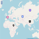 WP Open Street Map 》使用 OpenStreetMap 輕鬆創建地圖。 這裡有一些示例, 還有更多選項的 Pro 版本: https://www.info-d-74.com/en/produit/wp-openstreetmap-pro-plugin-wordpr...。
 Custom Post Type to Map Store 》此外掛允許你:, , 從樣本文章中的座標產生GEOJson資訊流。, 透過簡碼在地圖上顯示此資訊流。, , 功能, , 從文章類型進行映射以產生所有文章的 GeoJson 資訊...。
 bbPress Topic Location 》這個外掛可供 bbPress 使用,可以將主題地理位置設定,並且使用範圍和位置篩選主題。, 它最初是為了分類廣告論壇設計。, 功能, , 前端和後端均可操作, 使用者...。
 WP to Grawler 》WP to Grawler 是一個一鍵式的外掛,可使用 Grawler API 將您的地理位置內容分享到行動應用程式。, 使用此外掛,任何網站或部落格都可以將其地理位置內容上傳...。
 COSM 》這個外掛允許你在網誌上使用 Cloudmade Open Street Map 服務。。