前言介紹
- 這款 WordPress 外掛「Google Maps CP」是 2012-09-30 上架。
- 目前有 4000 個安裝啟用數。
- 上一次更新是 2025-03-26,距離現在已有 38 天。
- 外掛最低要求 WordPress 3.0.5 以上版本才可以安裝。
- 有 31 人給過評分。
- 還沒有人在論壇上發問,可能目前使用數不多,還沒有什麼大問題。
外掛協作開發者
外掛標籤
maps | shape | marker | places | Google Maps |
內容簡介
Google 地圖功能:
► 在您的博客中最佳位置插入 Google 地圖
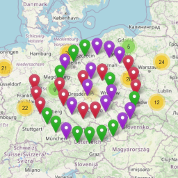
► 在 Google 地圖上處理大量的標記
► 使用 Google 地圖查找與文章有關的其他條目
► 可以根據物理地址和點座標來定義位置
► 地圖標記可自訂
► 可以嵌入多種語言的 Google 地圖
► 允許多種 Google 地圖控件和配置選項
Google Maps CP 可以在文章中或任何顯示多個文章的 WordPress 模板中插入 Google 地圖。
在單個文章中插入的 Google 地圖會在帖子提供的地理位置信息所指示的位置顯示標記,但也會顯示相關類別的最新帖子的標記。可以在插件的設置中設置在 Google 地圖上顯示的標記數量。
在顯示多個文章的模板中插入的 Google 地圖將包含與相關地理位置信息相關聯的文章中的所有帖子所構成的標記。當鼠標懸停在標記上時,會突出顯示屬於該標記的文章。
Google 地圖具有廣泛的設置,使您的地圖更具彈性和適應性。
有關 Google 地圖 CP 主要功能的更多信息:
此插件可處理大量的點或標記。
讓使用者以另一種方式查找與帖子相關的其他條目。
可以根據物理地址和點座標定義位置信息。
可以在博客中最佳位置插入 Google 地圖,或僅將地理位置信息與帖子關聯但不顯示 Google 地圖。
標記自訂。
顯示或隱藏標記信息的氣泡。
允許顯示預設打開的氣泡。
基於 Google 地圖 Javascript API 第 3 版。
允許在多種語言中嵌入 Google 地圖。
顯示屬於同一類別的帖子的標記。
有多種自定義選項:初始縮放級別、寬度、高度、邊距、對齊方式、地圖類型、地圖語言、在單個文章中顯示地圖的方式(完全展開或顯示 Google 地圖的圖標)、啟用或禁用地圖控件、在 Google 地圖上繪製的點的數量,以及當鼠標懸停在與帖子相關聯的標記上時將分配給帖子的類別。
Google 地圖 CP 的高級功能:
加載屬於特定頁面或帖子的點。
在同一張地圖上加載屬於特定類別的所有點。
在同一張地圖上加載與所有帖子相關聯的點。
顯示屬於具有特定標籤的帖子的點。
地點信息和描述可用於帖子搜索。
允許將多個 Google 地圖點關聯到每個文章/頁面。
允許在同一帖子中通過點繪製路線。
在地圖上包括搜索框,以搜索其他地方。
在 Google 地圖上繪製形狀。
允許創建具有類別、標籤或自定義分類法的圖例,並顯示或隱藏點,檢查或取消選擇圖例項目。
包括一個鏈接,以從 Google 地圖獲取到點的方向。
包括一個鏈接,直接在 Google 地圖上打開該點。
包括一個鏈接,直接在特定點上顯示街景視圖。
允許在同一篇文章/頁面中顯示多個 Google 地圖(但在頁面上所有地圖中顯示相同的點)。
允許將地圖插入小工具中。
原文外掛簡介
Google Map features:
► Insert a Google map in the best position within your blog
► Deal with large volumes of dots or markers on the Google Maps
► Uses Google Maps to discover additional entries related to the post
► The location can be defined by physical address and point coordinates
► Map markers customization
► Allows to embed Google Maps in multiple languages
► Allows several Google Maps controls and configuration options
Google Maps CP allows to insert a Google Maps in a post or in any of the WordPress templates that display multiple posts.
The Google Maps inserted in a single post displays a marker at the position indicated by the geolocation information pertaining to the post, but also shows markers of the last posts published in related categories. The number of markers to display on the Google Maps can be set in the plugin’s settings.
The Google Maps inserted into a template displaying multiple posts will contain as many markers as posts making up the page with the associated geolocation info. When the mouse is hovered over the marker, the post to which it belongs gets highlighted.
Google Maps has a wide range of settings to make your maps more versatile and adaptable.
More about the Main Features of Google Maps CP:
The plugin is capable of dealing with large volumes of dots or markers.
Another way for users to discover additional entries related to the post.
The location information can be defined by physical address and point coordinates.
Allows to insert the Google Maps in the best position within your blog or simply associate the geolocation information to the post but without displaying the Google maps.
Markers customization.
Display or hide the bubbles with markers information.
Allows to display a bubble opened by default.
Based on Google Maps Javascript API Version 3.
Allows to embed Google maps in multiple languages.
Displays markers belonging to posts of the same categories.
Several customization options are available: initial zoom, width, height, margins, alignment, map type, map language, the way the map is displayed in a single post (either fully deployed or icon to display the Google maps), enable or disable map controls, the number of points plotted on a Google map, as well as the class that will be assigned to the post when the mouse hovers over the marker associated with the post.
Allows to styling the map.
Premium Features of Google Maps CP:
Load points belonging to specific pages or posts.
Load in a same map all points that belong to a specific category.
Load in a same map the points associated to all posts.
Display the points that belong to the posts with a specific tag.
The location information and description may be used in posts search.
Allows to associate multiple Google maps points to each post/page.
Allows to draw routes through points in the same post.
Include a search box on the map for searching additional places.
Draw shapes on the Google Maps.
Allows to create a legend with categories, tags, or custom taxonomies, and display or hide the points, checking or unchecking legend items.
Include a link to get directions to the point from Google Maps.
Include a link to open the point directly on Google Maps.
Include a link to display directly the street view in the specific point.
Allows to display multiple Google Maps in the same post/page (but displays the same points in all maps on page).
Allows to insert the map as widget on sidebars.
Allows grouping multiple markers in a cluster.
Allows to display the user location on map.
Allows to refresh the user location on map in the time interval defined in the map’s settings.
Generates dynamic points from the geolocation information, stored in the image’s metadata when it is uploaded to WordPress, and includes a button for processing all previous images.
Generates dynamic points on map, relative to the geolocation information, assigned to the posts from WordPress App.
Allows to associate the Google maps with any public post_type in WordPress.
In non singular webpages, Google Maps display a map for each post.
Allows to export all points defined in the website to a CSV file.
Allows to import the points from a CSV or KML file.
Allows to load a KML layer on the map from a KML file.
The third, and most extended version of the plugin is the “Developer Version”. The Developer version of the Google Maps CP plugin includes all features of the Premium version, and the features listed below:
Developer Features of Google Maps CP
Allows design a Contact Form, and associate it with the points in the map.
Send notification emails with the information collected by the form.
Associate an email address to the points, to contact a different person by each point, or a global email address to be notified from all points.
Supports Contact Form 7 plugin’s forms in the points’ descriptions by inserting their shortcodes (
錯誤: 找不到符合條件的聯絡表單。
)Allows to use the image associated with the point as the point’s icon on map.
Demo of the Developer Version of Google Maps CP Plugin
https://demos.dwbooster.com/cp-google-maps/wp-login.php
https://demos.dwbooster.com/cp-google-maps/
Note 1: To display all points that belong to a specific category in the same Google Map, it is required to insert the following shortcode [codepeople-post-map cat="3"]. The number 3 represent the category ID, replace this number by the corresponding category’s ID. To insert the code directly in a template, the snippet of code would be:
Note 2: To display all points that belong to more than one category in a same Google Map, separate the categories IDs with the comma symbol [codepeople-post-map cat="3,5"]. The numbers 3 y 5 are the categories IDs, replace these numbers by the corresponding categories IDs. To insert the code directly in a template, the snippet of code would be:
Note 3: To display all points defined in the website in a same Google Map, use -1 as the category’s ID:
[codepeople-post-map cat="-1"]
or
for template.
Note 4: To display all points that belong to the posts with a specific tag assigned in a same Google Map, for example the tag name “mytag”, use the shortcode’s attribute “tag”, as follows: [codepeople-post-map tag="mytag"]. To insert the code directly in a template, the snippet of code would be:
Note 5: To display the points belonging to specific posts or pages in a same Google Map, enter their ids separated by comma through the “id” attribute in the shortcode as follows: [codepeople-post-map id="123"]. To insert the code directly in a template, the snippet of code would be:
The “id” attribute has preference over the rest of the filtering attributes.
If you prefer configure your map directly from the shortcode, then you must enter an attribute for each map feature to specify. For example:
[codepeople-post-map width="500" height="500"]
The complete list of allowed attributes are:
Very Important. Some of attributes are available only in the premium and developer versions of the plugin.
width: Values allowed, number or percentage. Defines the map’s width:
[codepeople-post-map width="300"]
or
[codepeople-post-map width="100%"]
height: Values allowed, number or percentage (In the web’s development, the height in percentage is effective only if the parent element has a height defined). Defines the map’s height:
[codepeople-post-map height="300"]
align: Values allowed, left, right, center. Aligns the map’s container to the left, right or center:
[codepeople-post-map align="center"]
dynamic_zoom: Values allowed, 1 or 0. Adjust the zoom of map dynamically to display all points on map at the same time:
[codepeople-post-map dynamic_zoom="1"]
zoom: Accepts a number to define the map’s zoom. To apply a zoom to the map, the dynamic zoom should be 0:
[codepeople-post-map dynamic_zoom="0" zoom="5"]
type: Values allowed, SATELLITE, ROADMAP, TERRAIN and HYBRID. Select the type of map to display:
[codepeople-post-map type="ROADMAP"]
language: Values allowed, en for English, es for Spanish, pt for Portuguese, etc. (for the complete list, check the Google Maps documentation). Select a language to display on map:
[codepeople-post-map language="en"]
route: Values allowed, 0 or 1. Draw or not the route between points in a same post or page:
[codepeople-post-map route="1"]
mode: Values allowed, DRIVING, BICYCLING and WALKING. Define the type of route:
[codepeople-post-map route="1" mode="DRIVING"]
show_window: Values allowed, 0 or 1. To enable or disable the infowindows:
[codepeople-post-map show_window="1" ]
show_default: Values allowed, 0 or 1. Display or not an infowindow expanded by default:
[codepeople-post-map show_window="1" show_default="1"]
markerclusterer: Values allowed, 0 or 1. Displays a cluster with the number of points in an area:
[codepeople-post-map markerclusterer="1"]
mousewheel: Values allowed, 0 or 1. Enables the map’s zoom with the mouse wheel:
[codepeople-post-map mousewheel="1"]
zoompancontrol: Values allowed, 0 or 1. Displays or hide the zoom controls in the Google Maps:
[codepeople-post-map zoompancontrol="1"]
typecontrol: Values allowed, 0 or 1. Displays or hide the type control in the Google Map:
[codepeople-post-map typecontrol="1"]
streetviewcontrol: Values allowed, 0 or 1. Displays or hide the street-view control in the Google Map:
[codepeople-post-map streetviewcontrol="1"]
defaultpost: Defines the post ID, for centring the map, and display by default the infowindow corresponding to the first point associated to this post:
[codepeople-post-map defaultpost="396"]
center: To define the center of the map, but if the infowindows are configured to be opened by default, the map will be centered in the point with the infowindow opened:
[codepeople-post-map center="40.7127837,-74.00594130000002"]
legend: Accepts a taxonomy name as value. Some common taxonomies names are: category and post_tag, for the categories and tags, respectively. Displays the legend with the list of elements that belong to the taxonomy and are assigned to the posts associated with the points:
[codepeople-post-map legend="category"]
legend_title: Text to be used as legend title:
[codepeople-post-map legend="category" legend_title="Select the categories to display on map"]
legend_class: Class name to be assigned to the legend. The legend design may be modified through CSS styles. Creates a class name, with the styles definition, and associates the new class name to the legend through the legend_class attribute:
[codepeople-post-map legend="category" legend_class="my-legend-class"]
tag: Tags slugs separated by “,”. Displays on map the points whose posts have assigned the tags:
[codepeople-post-map tag="tag1,tag2,tag3"]
cat: Categories IDs separated by “,” or -1. Displays on map the points whose posts belong to the categories. The special value -1, allows display on map all points defined in the website:
[codepeople-post-map cat="2,4,56"]
[codepeople-post-map cat="-1"]
excludecat: Categories IDs to exclude, separated by “,”. From points to be displayed on map, the plugin excludes the points whose posts belong to the categories to exclude:
[codepeople-post-map tag="tag1,tag2" excludecat="4"]
excludepost: Posts IDs to exclude separated by “,”:
[codepeople-post-map cat="-1" excludepost="235,260"]
excludetag: Tags IDs to exclude separated by “,”:
[codepeople-post-map excludetag="2,13"]
taxonomy: The taxonomy is a special attribute that should be combined with other attributes, depending of taxonomies to use for points filtering. Suppose the website includes two new taxonomies: taxonomyA and taxonomyB, and the map should display all points that belong to the posts with the value T1 for taxonomyA, and T3,T4 for taxonomyB, the shortcode would be:
[codepeople-post-map taxonomy="taxonomyA,taxonomyB" taxonomyA="T1" taxonomyB="t2,t3"]
Note 5: The geolocation information is stored in image’s metadata from mobiles or cameras with GPS devices.
Note 6: Some plugins interfere with the shortcodes replacements, and provokes that maps don’t be loaded correctly, in this case should be passed a new parameter through the shortcode print=1
Passing the parameter print=1, displays the map at beginning of page/post content.
Note 7: To display in the Google Map all points in posts with a specific taxonomy assigned, or multiple taxonomies, should be used the “taxonomy” attribute in the shortcode, with the list of all taxonomies separated by the comma symbol, for example: taxonomy=”taxonomy1,taxonomy2″, and a new attribute for each taxonomy with the values corresponding. For example if you want select the points that belong to the posts with the values: “value1” for “taxonomy1”, the shortcode would be:
[codepeople-post-map taxonomy="taxonomy1" taxonomy1="value1"]
for multiple taxonomies:
[codepeople-post-map taxonomy="taxonomy1,taxonomy2" taxonomy1="value1" taxonomy2="value2,value3"].
post_type: In combination with other attributes like: cat, tag or taxonomy, it is possible to load on map only the points that belong to the post types in the list:
[codepeople-post-map cat="-1" post_type="post,page"]
excludepost_type: In combination with other attributes like: cat, tag or taxonomy, it is possible to load on map only the points that do not belong to the post types in the list:
[codepeople-post-map cat="-1" excludepost_type="post"]
kml: Absolute URL (http://…) to a KML file with the Keyhole Markup Language:
[codepeople-post-map kml="http://www.yourwebsite.com/your-file.kml"]
If you want more information about this plugin or another one don’t doubt to visit my website:
http://wordpress.dwbooster.com/content-tools/codepeople-post-map
Interface
Google Maps offers several setting options and is highly flexible. Options can be set up in the Settings page (and will become the default setup for all maps added to posts in the future), or may be specific to each post to be associated with the Google maps (in this case the values are entered in the editing screen of the post in question.)
The settings are divided into two main groups, those belonging to the Google maps and those belonging to the geolocation point.
Google Maps configuration options:
Map zoom: Initial map zoom.
Dynamic zoom: Allows to adjust the map’s zoom dynamically to display all points at the same time.
Map width: Width of the map.
Map height: Height of the map.
Map margin: Margin of the map.
Map align: Aligns the map at left, center or right of area.
Map type: Select one of the possible types of maps to load (roadmap, satellite, terrain, hybrid).
Map language: a large number of languages is available to be used on maps, select the one that matches your blog’s language.
Allow drag the map: allows drag the map to see other places.
Map route: Draws the route through the points that belong to the same post (available only in the premium and developer versions of plugin)
Travel Mode: Travel mode used in route drawing (available only in the premium and developer versions of plugin)
Include Traffic Layer: Displays a traffic layer over the map.
Show info bubbles: display or hide the bubbles with the information associated to the points.
Display a bubble by default: display a bubble opened by default.
Display map in post / page: When the Google maps are inserted in a post you can select whether to display the Google maps or display an icon, which displays the map, when pressed (if the Google maps are inserted into a template that allows multiple posts, this option does not apply)
Options: This setting allows you to select which map controls should be available.
Display a …
各版本下載點
- 方法一:點下方版本號的連結下載 ZIP 檔案後,登入網站後台左側選單「外掛」的「安裝外掛」,然後選擇上方的「上傳外掛」,把下載回去的 ZIP 外掛打包檔案上傳上去安裝與啟用。
- 方法二:透過「安裝外掛」的畫面右方搜尋功能,搜尋外掛名稱「Google Maps CP」來進行安裝。
(建議使用方法二,確保安裝的版本符合當前運作的 WordPress 環境。
1.1.0 | 1.1.1 | 1.1.2 | 1.1.3 | 1.1.4 | 1.1.5 | 1.1.6 | 1.1.7 | 1.1.8 | 1.2.0 | 1.2.1 | 1.2.2 | 1.2.3 | 1.2.4 | trunk | 1.0.44 |
延伸相關外掛(你可能也想知道)
 Map Multi Marker 》這個外掛是最簡單、有用和強大的 Google 地圖外掛!可輕鬆建立無數數量的 Google 地圖和標記點。有很多選項可供選擇,讓您完全自由地自訂地圖和標記點。, , ...。
 Basic Google Maps Placemarks 》BGMP 可建立一個自定義文章類型,用於在 Google 地圖上標記地點 (標記)。地圖是通過短碼嵌入到頁面或文章中,並有設置可影響它的顯示方式。您可以創建標記以...。
 Extensions for Leaflet Map 》這個 WordPress 外掛擴充了 Leaflet Map,並增加了 Leaflet 插件和其他功能。, 使用的 Leaflet 插件與元素, , leaflet-elevation、Leaflet.i18n:具備高程概...。
Just Highlight 》Just Highlight 是一個 WordPress 外掛,可用於在文章或頁面中突顯文字,讓您輕鬆創建突顯閱讀者真正關心的內容的美觀文章。, 如何使用?, * 使用游標選擇...。
 Maps – Google Maps 》Robo Maps – 最簡單強大的 WordPress 谷歌地圖外掛程式, Robo Maps 是一個易於使用且非常強大的 WordPress 谷歌地圖外掛程式。此外掛程式是以 WordPres...。
 Multiple Location Google Map 》Multiple Location Google Map 是一款易於使用的插件,不需要任何編程技能或自定義。MLGM 允許您在 Google 地圖上創建位置標記的自定義帖子類型,包括標題和...。
 Add Multiple Marker 》「Add Multiple Marker」外掛提供了多種方式來在單張地圖上顯示多個位置,並且可以使用不同的工具。它提供了以下多種選項:, , 在單張地圖上標記無限多個標記...。
WP Makerboard 》提供一個「標記板」小工具,讓訪客可以玩弄。當使用者的滑鼠游標移動到小工具上方時,標記會在表面上畫出。, 這個小工具有四個選項:線條顏色、線條寬度、方...。
SimpleGMaps 》您可以使用簡易地圖外掛在一頁中設置您的位置,使用 [simplegmaps] 短碼,您只需添加一個參數列表,, latitud(緯度),longitud(經度),zoom,tipomapa(...。
Dev Corner Badge 》有時在開發主題或網站時,看起來非常類似(或完全相同)於生產版本的網站。安裝此外掛可快速讓您知道,您正在查看的是開發網站。, 新增功能!調整標籤的位置...。
 Very Simple WP MakerMap 》非常簡單的 WP 地圖製造程式是一個可以透過簡單的表單輕鬆創建定制地圖的外掛程式。我們使用 OpenLayers 程式庫和 OpenStreetMap。, 以下是其操作步驟:。
Places WP Lite 》Places WP 是最受歡迎的 WordPress 外掛之一,可為您的 WordPress 網站/部落格啟用地點支援。它能夠從基於 HTML 的瀏覽器位置共享屬性中收集用戶位置,, 並在...。
Pinpoint Free 》在照片上方添加彩色標記從未如此簡單。只需添加一個標記並將其拖動到所需位置。部落格訪客可以懸停並閱讀針的內容,點擊後可以重定向到產品頁面或部落格文章...。
Ez and simple Google Map 》感謝您選擇 Ez and simple Google Map 外掛, * 請別忘了給予此外掛評分。如有任何回饋或錯誤報告,可透過 [email protected] 聯繫作者, 透過此外掛,您...。
 Brikshya Map 》使用者可直接從 https://wordpress.org/plugins/brikshya-map 下載此外掛。若對於安裝外掛不夠熟悉,建議可參考 Google 搜尋相關資訊。。
